Four Metro Manila evacuation zones you need to know.
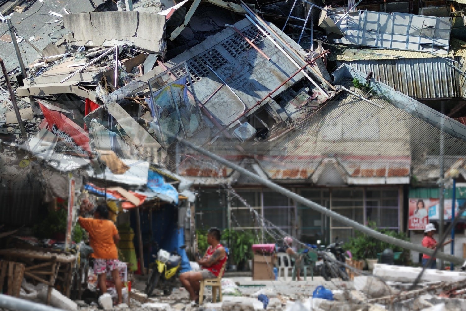
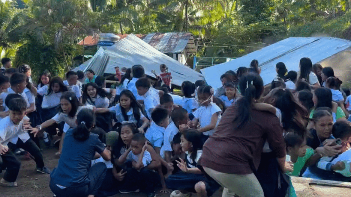
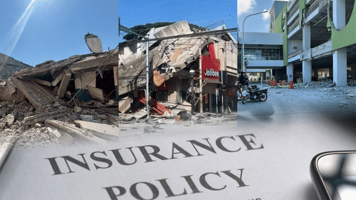
A Magnitude 7.2 earthquake will instantly collapse Metro Manila’s bridges and flyovers, cutting the capital into four isolated islands and blocking emergency responders.
To prevent total paralysis, the MMDA’s Oplan Metro Yakal Plus divides the metropolis into four independent, self-sustaining quadrants, each equipped with its own pre-designated master evacuation camp and emergency field hospital.
The North and East Quadrants: The healthcare hub
The North Quadrant serves as the capital’s primary healthcare refuge, encompassing Quezon City, Caloocan, Valenzuela, San Juan, and Mandaluyong. If you are caught in these areas, you must look for open ground away from dense commercial zones.
The designated primary evacuation camps for this sector are the sprawling Veterans Memorial Medical Center (VMMC) Golf Course and the expansive UP Diliman Grounds, while emergency field hospitals will be rapidly deployed at both the VMMC compound and the Quezon Memorial Circle.
Meanwhile, the East Quadrant acts as the high-risk Valley Response Zone, covering Pasig City and Marikina City—the two localities directly hugging the active fault line.
Because of their extreme proximity to the epicenter, residents here must immediately route to Marikina Boys Town, the Red Cross Compound in Marikina, or the ULTRA (PhilSports Complex) in Pasig, with emergency medical operations centralized at the LRT-2 Santolan Station Depot.
The West and South Quadrants: Coastal refuges and financial safety nets
For those located near Manila Bay, the West Quadrant covers the City of Manila, Malabon, and Navotas. This dense, historic sector relies heavily on the Intramuros Golf Course to serve as both its primary evacuation camp and emergency field hospital.
The thick, historical stone walls and wide-open greens of the golf course provide a much-needed structural buffer zone, keeping evacuating crowds safe from collapsing high-rises and crowded residential blocks.
On the other hand, the South Quadrant covers the sprawling financial and residential districts of Makati, Taguig (BGC), Pasay, Parañaque, Las Piñas, Muntinlupa, and the municipality of Pateros.
If the disaster strikes while you are in this sector, the primary evacuation sanctuary and field hospital operations will be entirely centralized at the Villamor Air Base Golf Course in Pasay City.
Stay in the quadrant
When “The Big One” hits, forget going home. Roads will be impassable, bridges severed, and falling debris lethal. If you are working in BGC but live in Quezon City, do not cross town. Your absolute survival mandate is to stay put and head to your current sector’s nearest evacuation point—like Villamor Air Base for the South.
Remember these public golf courses
The MMDA’s decision to utilize golf courses like Veterans, Intramuros, and Villamor as primary disaster hubs is brilliant. In a catastrophic urban earthquake, the number one cause of casualties is not the ground shaking itself but falling debris—collapsing concrete walls, shattering glass facades, and snapping overhead power lines.
Golf courses are massive, wide-open green spaces completely devoid of potential debris Furthermore, these terrains provide perfect, clear zones for military helicopters to land safely, allowing emergency personnel to drop off critical medical supplies and airlift the severely injured when all roads are blocked.
Surviving “The Big One” requires clear-headed planning, not panic. Understanding Oplan Metro Yakal Plus provides the advantage needed during the first 72 hours of complete isolation. Memorizing these four independent quadrants and their open-air assembly points is key to survival.
READ: